Content
Automated sensor-based systems for quantifying visitor numbers and analyzing temporal and spatial visitation patterns in natural areas.
Classification
Key characteristics
Tool description
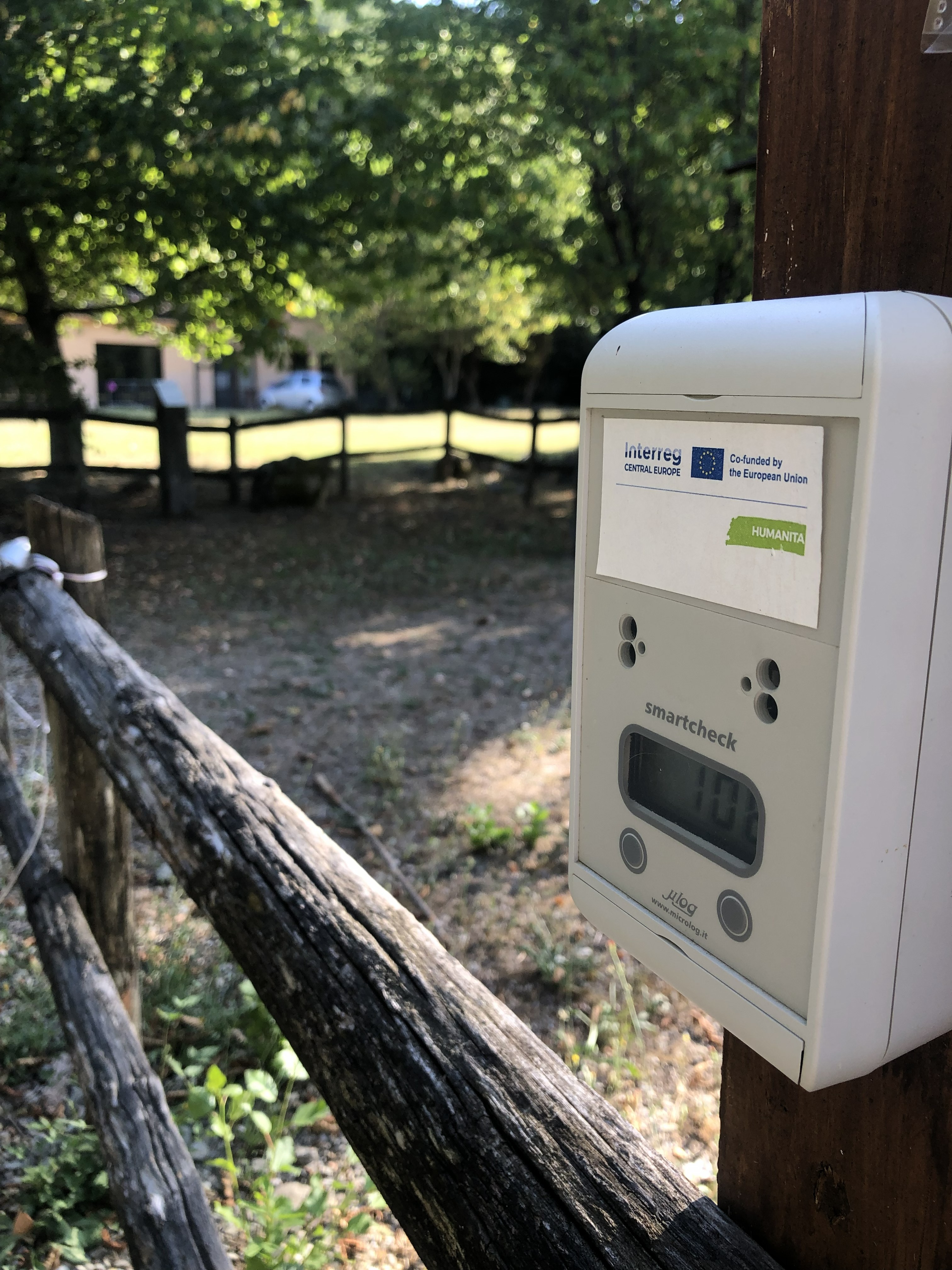
Automatic visitor counters are sensor-based monitoring devices used to quantify visitor flows and assess spatial and temporal patterns of human presence in natural and protected areas. Each passage is recorded as a time-stamped numerical event, enabling aggregation and analysis of hourly, daily, weekly, and seasonal visitation trends.
Different technologies are available depending on site characteristics and user types:
- Infrared beam counters detect interruptions of an invisible light beam and are commonly used on narrow trails.
- Radio-beam sensors operate similarly but may offer improved performance in certain environmental conditions.
- Magnetometers detect disturbances in the Earth’s magnetic field caused by bicycles or vehicles.
- Induction loops installed beneath the surface detect metal objects such as bicycles or motor vehicles.
- Thermal or pyroelectric sensors measure body heat to detect pedestrian movements.
The choice of technology depends on the monitoring objective (pedestrians, cyclists, vehicles), site configuration, expected visitor density, and environmental conditions.
Automatic visitor counters do not collect personal or identifiable data. They support long-term monitoring of anthropogenic pressure, visitor distribution, infrastructure planning, and adaptive management in recreational and protected areas.
Constraints
- Counting accuracy depends strongly on correct sensor placement (height, angle, alignment).
- Overcounting or undercounting may occur with groups or bidirectional traffic.
- Environmental factors (snow cover, vegetation growth, debris, flooding) may obstruct sensors.
- Magnetometers and induction loops detect only metal objects and are unsuitable for pedestrian-only monitoring.
- Devices do not provide visual validation; counting errors may remain undetected without field verification.
- Technical malfunctions or battery depletion may cause data gaps.
- Installation feasibility depends on terrain and substrate conditions.
Requirements
- Appropriate sensor type (infrared, radio-beam, magnetometer, induction loop, thermal sensor) based on monitoring objectives
- Mounting infrastructure (posts, poles, underground housing where applicable)
- Installation tools (screws, anchors, drilling equipment if required)
- Power supply (batteries or external power source)
- Personnel for installation, calibration, and regular maintenance
- Data retrieval system (manual download or remote transmission)
- Data management and analysis software
- Periodic field inspections to ensure correct functioning
Tool Impact
Best Practices
-
Automatic visitor counters were installed along trails, entrances, and access points within the Interreg CE project HUMANITA to monitor visitor flows in pilot sites. Locations were selected to capture representative movement patterns and to assess visitor pressure in sensitive natural areas. Long-term deployment enables analysis of peak hours, weekday versus weekend differences, and seasonal trends. The data supports interpretation of visitor pressure in relation to ecological monitoring results.
Helpful hints to use the tool proficiently
- Install counters at narrow trail sections or bottlenecks to improve counting accuracy.
- Avoid locations with wide, unconstrained movement where visitors may pass simultaneously.
- Carefully calibrate sensors during installation and conduct initial validation counts.
- Perform regular field checks to verify alignment, battery status, and environmental obstructions.
- Record contextual information (weather conditions, special events, trail closures).
- In bidirectional traffic areas, consider dual-sensor systems to differentiate direction.
- Combine automatic counters with periodic manual observations for validation.
- Use protective housings and discreet installation in high-use areas to reduce vandalism risk.
- Plan maintenance visits before peak seasons to avoid data loss.
- Archive raw data systematically to enable long-term trend analysis and comparison across years.
Specification
| Category | Device / Key |
| Properties |
Measurement device
Sensor
Small/light
|
| Range |
ground
local
|
Linked tools
| Category | Tool title and description |
Study object
|
Study focus
|
Work step
|
Tool purpose
|
Classic | Professional | Free to use | Experimental |
|
AI-based visitor counting from photo and video data
Use of AI-based image and video analysis software to automatically detect and count visitors from camera data, supporting continuous and non-intrusive monitoring of visitor numbers and flows in protected areas. |
|
|
|||||||
|
Camera traps for visitor monitoring
Passive recording of human presence along trails and access points using motion-triggered camera traps. |
|
|
|||||||
|
GPS Loggers for visitor monitoring
Portable devices used to record visitor movement patterns, routes, speed, and stay times, providing spatially explicit data to better understand visitor flows and site use. |
|
|
|||||||
|
MegaDetector Video Counting
Adapted MegaDetector algorithm (AI model that identifies animals, people and vehicles in camara trap images) to count animals, people and vehicles in short videos. |
|
|
|||||||
|
Mobile phone network data for visitor monitoring
Use of anonymized and aggregated mobile network event data to estimate visitor numbers and origin areas for selected protected areas and surrounding regions. |
|
|
|||||||
|
Outdoor app data for visitor monitoring
Analysis of outdoor app data (.gpx and metadata) to understand spatial distribution of digital trails and estimated usage of trails. |
|
|
|||||||
|
Strava Metro
Strava Metro is a data service provided by Strava that uses aggregated and anonymized activity data (e.g. walking, running, cycling) from users of the Strava app to analyze movement patterns. |
|
|
Gallery
Images
