Content
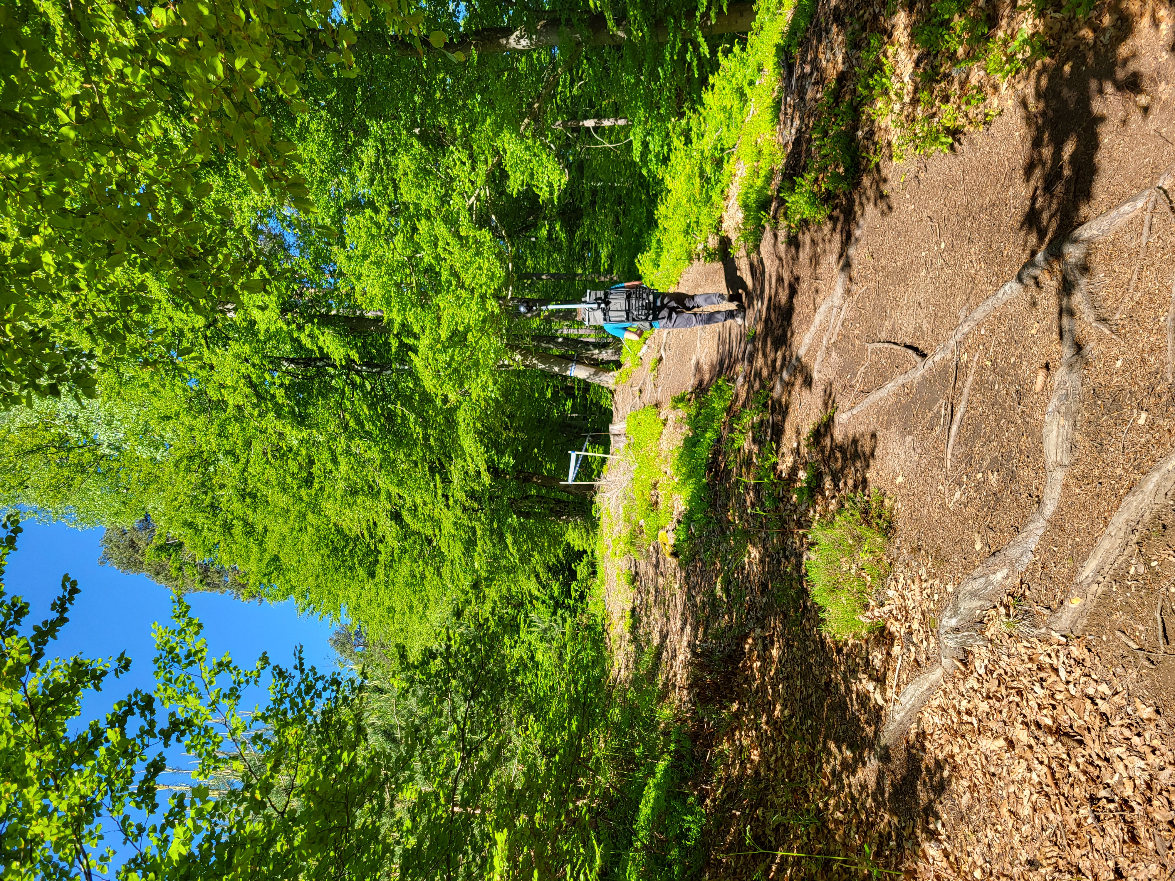
Mobile ground-based spherical imaging performed with a 360° photogrammetric sensor carried by an operator along a selected trail to map the terrain.
Classification
Key characteristics
Tool description
Constraints
- Limited spatial coverage compared to aerial methods.
- Accuracy depends on camera positioning and operator movement.
- Requires post-processing workflows that are still semi-standardized.
Requirements
- 360° camera with sufficient image quality and GNSS receiver
- Appropriate support to carry the equipment (i.e., backpack)
- Software for spherical image processing
Tool Impact
Best Practices
-
Bruno, N., Valletta, A., Segalini, A., and Roncella, R. (2024.: Low-cost techniques for soil erosion monitoring on mountain trails. Int. Arch. Photogramm. Remote Sens. Spatial Inf. Sci., XLVIII-2/W8-2024, 53–60, https://doi.org/10.5194/isprs-archives-XLVIII-2-W8-2024-53-2024.
This study, developed within the Interreg Central Europe HUMANITA project, explores cost-effective geomatics techniques for monitoring soil erosion on mountain trails. Among the tested approaches, ground-based spherical photogrammetry using 360° cameras proved particularly suitable for surveying narrow, vegetated trails where aerial methods are limited. The research demonstrates how portable and relatively low-cost monitoring technologies can provide detailed and repeatable data to support erosion assessment and sustainable trail management in conservation areas.
Helpful hints to use the tool proficiently
- Operators should adapt their walking pace to the image capture rate of the panoramic camera to ensure uniform spatial coverage and consistent data quality.
- Adjust camera parameters, such as shutter speed, according to the technical characteristics of the device and the desired area coverage and image clarity.
- Verify the availability of suitable mounting or carrying systems for transporting the panoramic camera during field surveys. Depending on the camera size, weight, and stabilization requirements, it may be necessary to design or adopt custom-made supports (e.g., modified backpack) to ensure safe handling and consistent data acquisition.
Specification
| Category | Device / Key |
| Properties |
Measurement device
Sensor
Small/light
|
| Range |
ground
local
|
Linked tools
| Category | Tool title and description |
Study object
|
Study focus
|
Work step
|
Tool purpose
|
Classic | Professional | Free to use | Experimental |
|
Backpack LiDAR scanner for erosion monitoring
Mobile ground-based LiDAR system for high-resolution 3D mapping of terrain and small-scale surface changes. |
|
|
|||||||
|
Mobile Laser Scanner (MLS)
portable 3D scanning technology for data capture and point cloud generation |
|
|
|||||||
|
Onboard LiDAR sensor
Light Detection And Ranging (LiDAR) sensor to scan the environment. |
|
|
|||||||
|
Photogrammetry
Technology to obtain information about physical objects and the environment through recording, measuring and interpreting photographic images. |
|
|
|||||||
|
UAV-based LiDAR scanning for erosion monitoring
UAV-based LiDAR scanning for erosion monitoring enables detailed, high-resolution mapping of terrain changes over time. It allows accurate detection and quantification of erosion processes across large areas without the need for extensive field surveys. |
|
|
|||||||
|
UAV-based photogrammetry for erosion monitoring
Aerial photogrammetric survey aimed at determining soil erosion on existing trails and identifying unofficial paths due to trampling. |
|
|