Content
iNaturalist is a citizen science platform that enables visitors and local communities to document plant and animal species through georeferenced photo observations.
Classification
Key characteristics
Tool description
Constraints
- Data quality depends on participant knowledge and photo quality.
- Species misidentification may occur without expert validation.
- Observations are often spatially biased toward accessible or popular areas.
- Participation levels may vary seasonally.
- Location accuracy may be insufficient for reliable use in management.
- Requires active moderation and data review for reliable use in management.
Requirements
- Clear definition of target species list if used for citizen science projects
- Communication strategy to engage visitors and local communities
- Staff or experts to review and validate observations
- Data management workflow for downloading, filtering, and mapping records
- Compliance with data protection and platform policies
Tool Impact
Best Practices
-
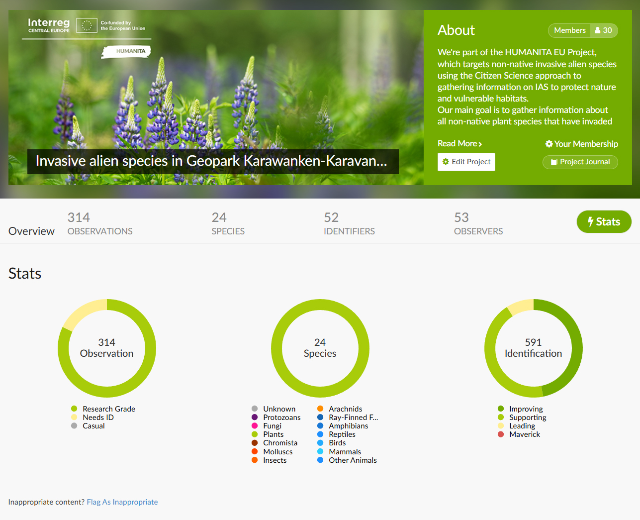
For the “Invasive plants in view” initiative, started during the Interreg CE project HUMANITA, iNaturalist was used to actively involve visitors, and local stakeholders in documenting invasive plant species. Clear communication about priority invasive species and simple identification guides improved information. It was demanding to reach visitors and locals to contribute data, even after 6 dedicated workshops in the pilot area arranged by Carinthia University of Applied Sciences and their partners, participation in the Long Night of Research to promote the project, direct communication to already active iNaturalist users, the involvement of the Citizen Science network Austria and the production of posters, flyers and information brochures only around 300 observations could be reached in 2 vegetation periods. This experience highlights that alot of communication effort is necessary to involve citizens in monitoring programs using apps like iNaturalist.
Helpful hints to use the tool proficiently
- Provide a clear list and visual guide of target species.
- Promote the project through visitor centers, guided tours, and schools.
- Encourage participants to upload clear, close-up photos.
- Regularly review and validate observations before management use.
- Download and archive data periodically for long-term monitoring.
- Communicate results (e.g., maps or findings) to maintain engagement.
- Remind participants to stay on trails and avoid disturbing habitats.
Specification
| Category | Software |
| Platform |
Portable
Web
|
| Operating system |
OS-independent
|
| Mode | Both online and offline |
Linked tools
| Category | Tool title and description |
Study object
|
Study focus
|
Work step
|
Tool purpose
|
Classic | Professional | Free to use | Experimental |
|
Biologer
Biologer is a simple and free software designed for collecting data on biological diversity.
|
|
|
|||||||
|
bird detectors
Bird detectors are acoustic devices that detect bird calls. Species identification of birds by means of acoustic monitoring has a high potential for biodiversity monitoring. The automatic recording and systemic evaluation of animal sounds offers the possibility of an area-wide monitoring of animal species relevant to nature conservation with minimal use of human resources.
|
|
|
|||||||
|
dendrometer
Tool for measuring diameter and/or height of a tree. |
|
|
|||||||
|
Flora Incognita
App for automated or semi-automated identification of vascular plant species. |
|
|
|||||||
|
hand net
Small hand net for catching terrestrial insects/spiders through sweeping. Fine-meshed nets are called aerial nets and are suited to catch flying insects. Canvas-bagged nets are called sweep nets and can be used along the ground surface and in dense vegetation. |
|
|
|||||||
|
Pl@ntNet
App for automated or semi-automated identification of vascular plant species. |
|
|
|||||||
|
Plant Identification App
Software for automated identification of plant species based on photos. |
|
|
|||||||
|
plot sampling
In ecology, plot sampling is a method for density, biomass, cover and frequency estimation of targeted organisms in which plots are selected from within a survey region and sampled. |
|
|
|||||||
|
species identification key
Identification of species based on morphological traits. A standard species identification key is called a dichotomous key where stepwise assessment of unique physical characteristics of a specimen is made by a specialist. Each step leads to finer taxonomic classification. Species identification keys are usually used side-by-side with a collected sample of the plant or animal of interest because the specimen might need to be repositioned to see its unique physical characteristics. |
|
|
|||||||
|
Transect sampling
A transect is a set of measurement or observation points along a straight line. The transect gets sampled by walking along the straight line while one counts and records occurrences of the objects of study (e.g. insects, plants, fungi, ...) |
|
|
|||||||
|
VegApp
Android app for collection of vegetation data. |
|
|
|||||||
|
Visual identification
Technique where animals, plants, funghi and lichens are identified in the field by an expert. |
|
|